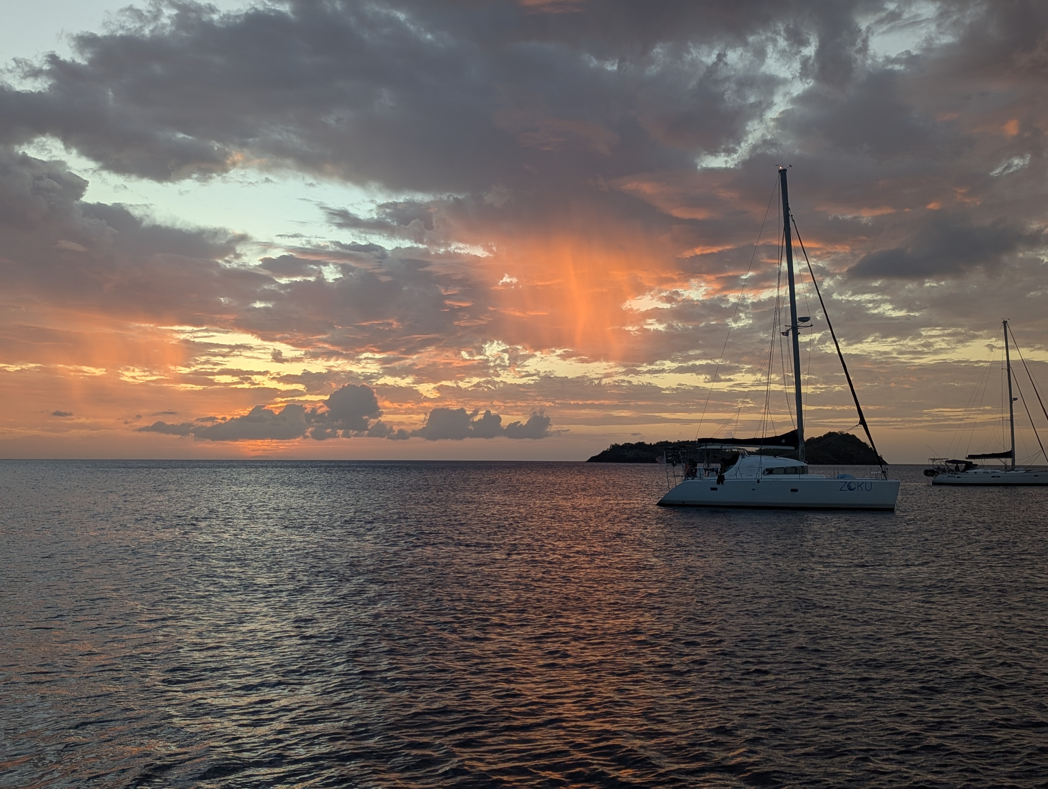
Tuesday, March 14, 2023

The Great Google Fi Lie


Years ago, while still roaming America in the RV, we switched our phone service to Google Fi. They promised seamless international coverage if we paid for the top tier pricing, Unlimited Plus plan. It's in the name.

Unlimited Plus? Nah, not really. Not for long anyways.

And seamless it was. All the way through the USA, and for brief forays into Canada here and there. Then in late 2020 and 2021 I heard nightmare stories of sailors who were unceremoniously cut off while stranded in places like Grenada as a result of the pandemic.

As if the pandemic wasn't isolating enough already.

As our Caribbean cruising plans started taking shape, I called Google Fi. All those sailors that were cut off - I didn't want to be one of them. I COULDN'T be one of them - I still work for a living after all. I was assured that because we have the Unlimited Plus plan that wouldn't happen to us. Those other poor souls must have had an inferior plan. All we needed to do was continue paying the top tier rate and everything would be fine.

Fast forward. We sailed away from Florida two months ago, all throughout the Bahamas and recently landed in the Dominican Republic. Our coverage has in fact been seamless. On the horizon is Puerto Rico and the US Virgin Islands, and ultimately Curacao for hurricane season. Then last night we got the dreaded "your data roaming is being cancelled in 30 days unless you go back to the USA" letter.

I called Google Fi. Surely there must be a mistake. I had taken steps to avoid this scenario after all. Nope. It's their policy to allow you 90 days of international roaming at a time before you must ping a USA cell tower. Regardless of which plan you are on. The rep actually told me "sorry if you misunderstood". !!!???!!

Misunderstood? I WAS LIED TO.

Anyhoo. I already run my workday on Starlink, and as long as Starlink is on we have unlimited high speed data. Google Fi will continue to operate for international text and telephone (at $0.20 a minute for phone calls), but for data I'll need to find wifi elsewhere. Many folks add a second SIM card for data in whatever country they are in so there's that new hassle and expense coming soon. The truth is that I'm addicted to Google Maps and use it to navigate all these places we don't know. Which is everywhere nowadays. Hence the purchase of the international plan.

Google Fi buyer beware. Unlimited is NOT unlimited. And if you misunderstood the meaning of "Unlimited Plus", well... too bad.

Saturday, March 11, 2023

The Kindness of Strangers


We arrived to Ocean World Marina in the Dominican Republic around 4am. The waves had been building all night and we surfed them right in to the harbor, and lacking further instructions, selected the easy landing spot on the fuel dock. Chloe still won't pee on the boat, so after holding it for almost two full days she was quite happy to jump off the boat for a few minutes. We raised our yellow Quarantine flag, tidied up for a short time and then all three of us passed out flat.


Minerva on the fuel dock at Ocean World

The next morning we were greeted by the Armada, which is the country's Navy and they keep a tight watch on all the goings-on in the harbor. They guided us through the customs process, which involved four different check-ins with different persons in uniform, a small fee paid and a new stamp in our passports. By lunchtime we were refueled and settled into a proper marina slip. The docks are fixed and there's a lot of water motion in the harbor as a result of the unusual North swell that we surfed in. Getting on and off the boat is tricky and requires agility and focus.

We had been warned that the 2-day passages are the hardest, this was our first one. The rumor is that on a longer passage your body settles into a routine by day 3 but the 2-day passages don't allow that to happen yet. We were pretty groggy still, and the late afternoon found us stumbling out in search of food into the open-air bar on the marina the locals lovingly refer to as "the yacht club".

Some rum was consumed.

After a while I could no longer deny the downward pull of my eyelids and Chloe and I checked ourselves into bed. Lance was making friends at the bar and shots were going around.

When I woke up around midnight I found him in the cockpit on the boat, he'd made it back safely. Whew. Without a cell phone, though.

The next morning we began the great cell phone hunt. I checked his phone location on Google Maps and it showed him offshore. Damn Google Maps, probably confused about our location again. When we retraced steps back to the yacht club, we heard the strangest story. The bar owner had been approached by the Armada at the crack of dawn. A fisherman had found a phone/wallet and immediately reported it found to the Armada, but put it in his pocket for safekeeping. The fishing is typically done by noon and he left the Armada to figure out the phone's owner in the meantime.

So Google Maps had it right. The phone was in fact on a fishing expedition offshore.

The Armada came by to check on us twice, the last time it was no less than the Comandante - the big cheese himself - who came out to let us know that "he's got us". Sure enough, when the fisherman came back the Comandante and 3 other Armada staff were standing on the dock to greet him. At least they weren't wearing the big guns this time around - those are going to take a little getting used to seeing.

I'd been following Lance's phone's motion on Google Maps and gave the fisherman a few minutes to settle in before I walked over and introduced myself. In Spanish he told me that on his way in at sunup he had found it on the ground covered by some gravel and was worried about leaving it unattended because his heart is so big. With a grin. He then told me he had caught a marlin, but because it was only 100 lbs he had let it go (with a little quick side eye at the Armada).

I called Lance's phone, so Jose the fisherman could see my face on it, and he said "you are eh Love Taco?". Yes. Yes I am. I blushed. The youngest of the Armada crew allowed a small half-smile. Jose handed over the phone. Everyone stood there for a moment. Another moment. Oh. I opened the wallet side of Lance's phone and took out the biggest bill in Dominican Republic currency there, approximately $20 US. Everyone relaxed. The Armada tipped their hat to me and left, and Jose was instantly smiles and laughs. Tension gone.

So... there are some cultural differences here.

It appears we can trust the guys with the big guns. In the Dominican Republic they check you into and out of each harbor, this way they carefully monitor who is roaming around their country and where. But it's not a bribe thing and it doesn't feel oppressive, it feels very structured in a way to keep us safely having a good time and therefore freely spending money. Despite their official appearance they are very friendly and seem to appreciate the presence of tourists.

The folks at the yacht club tell us phones are left there all the time and this is the first time the Armada has gotten involved. The difference is likely that Lance's phone is also a wallet with all the usual stuff that goes there like credit cards and cash. All of which was still there.

We feel very safe here.

Later in the day, Lance lamented that his wallet had gone marlin fishing without him. We have a new friend in Jose, though, so maybe marlin fishing WITH his wallet is in his future.

Wednesday, March 8, 2023

Goodbye Bahamas


Around 1 am Lance woke me up for my turn at the wheel. When I came up on deck I was greeted by the full moon and glassy seas, Minerva's trusty engine was humming contentedly and we were zipping along at 6.7 knots. There were a few fluffy clouds but the air felt dryer than usual.

Lance mumbled something about the radar overlay before nodding off, so I switched the view on the chartplotter over to check it out. Nothing but nothing. Well, except that one island just before our turn 4. Little Inagua, our last contact with the Bahamas island nation.

Fruit trees line the beach on Acklins Island. Research leads us to believe this one might be a "Five Year Apple"

Little Inagua is 50 square miles and completely uninhabited. We are passing it on our way to the Dominican Republic, and it seems like a natural touchstone for a lot of other passages too. We will come within a few miles of it, and I can't see it. At all. Nothing. Eerie. Even the cloud cluster that normally betrays every other Bahamian island location is missing.

Once again I muttered under my breath "Would it kill you to put a light on this thing? A marker? A bell? Something?"

Interesting sponges on Acklin Island

And I am struck again by how grateful I am to be doing this adventure with today's technology. I have full confidence in our chartplotter. Still, some visual or audio confirmation would be welcomed.

Without a chartplotter, we would have laid out this course on a paper chart and kept our eyes glued to the compass and the clock to ensure we remained faithful to the plan. Right about now, without visual confirmation, I'd be freaking out that we had miscalculated, and probably sweating and swearing a little bit. Maybe a lot.

Instead, we glide by it in the darkness while I nibble on a cookie and pet my sleepy dog. Goodbye Bahamas.


Sunday, February 19, 2023

Magic on Mackie Shoals


Dave pointed to a spot on the chart in the middle of nowhere. "We'll spend the night here".

I zoomed out the chart, and then zoomed it out again. There was no island anywhere nearby. The spot Dave pointed at was 37 mi from the backside of Bimini, and 50 miles or more to Chub Cay or Andros. I squinted my eyes and chewed on my lip. This goes against everything I know, but... this is our buddy boat and they have been here many times. They know the area. We do not. Why even have a buddy boat with local experience if you're not going to trust their guidance?

And the conditions did look perfect for it. Light winds in the morning going our way, then 2 days of peaceful calm.

And so began our journey to Mackie Shoals.

Beachscape under sail

The next morning we motored out of Bimini. As we approached the shallow sandbar that separates Bimini from the outside world, Lance was behind the wheel and I was perched on the bow watching carefully for any random coral that might cause trouble to Minerva. A giant ray glided past, and I could see the individual sand as we motored over it. In the Bahamas the clarity is such that you can see this level of detail even in 15 ft of water, so it all has the effect of looking alarmingly shallow. We followed our track out, made the sharp turn across the shallow shoal (holding our breath as if that somehow makes us lighter), and exited safely out into the open ocean. Minutes later we had Minerva's sails up.

As we turned East around the North side of Bimini, the royal blue water turned to turquoise and stretched on as far as the eye could see. Soon the depth readings under the boat were showing at a steady 10 feet. We sailed alongside our friends and other boats that followed us out, until the wind died as predicted at midday, then we fired up the motor and made some ice to stow away for the evening's cocktails.

Godspeed followed us out of Bimini and sailed along with us for a while

With nothing but turquoise water and blue sky in every direction for hours, it seemed out of place when we finally did come upon a lit marker and a few boats already at anchor. It's all 10 ft deep in every direction, and it's not like there are proper channel markers, it's just more or less casually understood that the direct line between Bimini and Chub Cay is the preferred highway, so we motored about a mile or so out of the way and dropped the hook at the outer edge of the other boats already anchored there.

I was still tidying up the boat from the journey when I heard the splash of Lance swimming. Cocktails and dinner soon followed, and that sunset disappearing into the beautiful turquoise water was something I will never forget.

Beachscape at anchor on Mackie Shoals

In the Bahamas cruisers show their appreciation for the sunset with the blow through a conch horn. Since we don't have one we make do by ringing the ship bell or howling with Chloe. 

Our buddy boat Beachscape in the late afternoon light on Mackie Shoals


Then the evening show began.

We brought the cushions and cocktails up onto the aft deck to witness the stars. So many stars; more stars than I've ever seen ever before. With no visible land in any direction, there was simply no light pollution. All the stars were so bright we couldn't even make out the constellations we're used to seeing.

We counted shooting stars and satellites until we passed out lying under the blanket of stars.

It was the most magical night.

As predicted, there was no wind the next morning and we motored the rest of the way to Chub Cay. For once, Lance wasn't grumbling about the motor running instead of the sails being out. We happily sipped our coffee as we motored along on the flat seas, both still under the spell of those crazy stars and a magical Bahamas night.

Motoring to Chub Cay with the sunrise on flat seas

Thursday, January 26, 2023

We've been tagged!


We were motoring back to Minerva from Chloe's afternoon run on Jaws Beach yesterday. The dinghy startled a squid that was resting in Minerva's shadow and it took off swimming so fast it launched itself right into the air... and headfirst into Minerva's hull. It hit so hard it swam around stunned for a moment, then came back to the surface, took aim and squirted ink all alongside Minerva's ladder and hull.

West Bay, New Providence Island, Bahamas

After the little temper tantrum display was finished it sort of wandered around under the hull squirting ink for a while before it pulled itself together enough to swim away. 

Later, while I was scrubbing ink off the hull and ladder, Lance was laughing at me "the things you never had to do as a homeowner".

Yep. We've been tagged by a tentacled hoodlum.

Friday, October 21, 2022

The Jersey Jump

Now where was that stupid charger? I had already torn the boat apart from bow to stern, seemed silly to do it again. It had to be hiding in plain sight.

So I went back through the electronic closet again and sure enough, there it was - pretending to be the charger for something else, when it actually belonged to the big flashlight. Aha! It was going to be a very long sail today, definitely an overnighter, gotta get some juice in that flashlight!


The Coney Island Light

Probably wise to look around at the other emergency equipment too. The little lights attached to our life vest are all charged and ready to go, they will come on automatically if wet. Snacks are prepared and standing by. Radio was working well, backup radio on standby and charged, inreach tracking and broadcasting our location, chartplotter and iPad playing well together, backup iPad charged and ready to deploy. Hopefully we never need any of this preparation, but we do it anyway.

We settled into easy shifts, taking turns at the helm while the off-duty crew napped.

Somewhere around 2am we lost all the wind, exactly as predicted. So we rolled in the headsail, tightened up the main and mizzen, and fired up our trusty new Beta. As Lance drifted off to dreamland I found myself obsessing over a weird collection of white and yellow lights offshore. It sort of reminded me of the big container ships we frequently encountered off the coast of Long Beach, CA, difficult to tell which direction they were going without visible red or green lights, just a mass of indecipherable white and yellow.

For a while they kept pace with us, sometimes veering away from us, sometimes getting closer. As we approached Atlantic City the vessel made a definite course change and the chart plotter started blaring alarms - we were on a collision course. I turned off the audible alarms and kept an eye on it, we were on a steady course and they were not changing course either. The GPS predicted that we would crash into one another within the hour.

Barnegat Light, on the Jersey Shore

As we drew closer, the vessel name popped up on the AIS - the Jersey Devil. A little more online research revealed it to be a fishing vessel, which gives it the right of way since we are motoring. I could have slowed down and passed behind it but if it was long line fishing... we do have a line cutter on our prop. I hope to never test it.

My thoughts drifted back to the story our friend told us last summer about the Jersey Devil as we passed by the family home built in the 1700s. He was the 13th child born on a stormy night and was greeted with disdain, until one day he reportedly turned into an actual devil, flew out the window and into the swamp where he was, and still is, blamed for all kinds of mischief.

Well, this devil with the strange lights and indecipherable intentions wasn't going to worry me. I picked up the radio and we worked out a deal, I would speed up and he would slow down and we would miss one another with no course changes. As he passed behind Minerva I noticed the lights that looked so strange from head-on were attached to huge outriggers, so it's good that I didn't try to pass behind him, he probably WAS dragging nets or lines. At least all of the weird motion offshore made sense now. Fishing activity. Now I know what that looks like in the dark: random. It looks totally random.


Atlantic City, NJ


Lance came up for his turn at the wheel as we left Atlantic City and the Jersey Devil in our wake. All the stars were out, and the breeze was starting to pick up a little bit. We debated sailing across the mouth of the Delaware Bay to our intended anchorage at Lewes, but ultimately decided since we were likely to encounter container and fuel ships en route to Philadelphia in the channel, and since the current would be against us and the wind was still slow, we would just motor the rest of the way, it wasn't far and keeping the motor on would reduce our exposure to the large fast-moving vessels.

Now, we both know the rules, it's best not to approach shore at night, but we felt confident here. We had been here before, the chart plotter was behaving and seemed to line up well with the markers, so onward we pushed, although Lance did reduce speed as we passed the breakwater wall. There should have been plenty of room between the end of the breakwater wall and the shore, imagine our surprise when we ground to a soft but sudden halt. According to the chart plotter and the markers, there should have been thirty feet or more between us and the shore. Surprise!

Remember that flashlight? Yeah... It revealed shoaling quite far out into the channel. Certainly beyond all indicators. Sometimes you do everything right and you screw up anyway. Freshly charged flashlight to the rescue - escape route revealed.

A friend once told us of a "good captain box" theory. All the little things you do to check, recheck, make backup plans, rest, buy and maintain top of the line equipment - it all goes into this imaginary box. And now and then when shit goes sideways, you hope that you put enough good things in the box to make a difference.

Jersey Devil vs AIS and a good radio, win.
Delaware shore vs flashlight, we'll call that one a draw.


Lighthouse at Lewes Anchorage

Tuesday, September 20, 2022

Passage Planning

The goal for every sailing day is good wind, minimal swell, cooperative tide and current. There's a lot that goes into passage planning to make all of this come together.

The first step is to pick your route. In this case, we are jumping around the outside of New Jersey, heading South in the open Atlantic. Our route will take us against the generally prevailing swell and wind, so we are looking for that rare window when the swell is minimal and the wind comes from anything other than its usual direction. 

Our first intent was to leave on Friday, because it had a speedy tailwind. We would be truly flying! Our friend Al told us last night he wants to leave on Tuesday (today). Let's compare the days.


Wind: this is Predictwind's Friday routes. The second boat which represents a noon departure would have 20-25 knot broad reach winds most of the day. 

Predictwind's Tuesday wind routes: The first boat which represents a 7am departure would have mild-moderate run and reach winds most of the day, with a lull in the middle of the passage which will likely require some motoring. Later departures the same day are much the same, light winds with some motoring required.


We use a variety of tools for planning. We usually start with Windy.com to get an overview of generally what the wind and rain are planning. In this case there is a high pressure over New York which is rejecting the approach of the offshore hurricane Fiona. On Friday the remnants of a storm currently hitting California will arrive here, bringing strong winds from the NorthWest.

The latest addition to our toolbox is PredictWind. It took us some time to set it up with the tolerances of Minerva and her crew, and like any new tool the more energy we invest in it the better we can make it work for us. With the weather routing enabled, we can find the best travel windows.

Then it's back to Windy to check the swell. It's no fun beating into big waves. PredictWind may have a swell overlay as well, I haven't explored that yet.

Friday's swells as seen on Windy. Ugly.

Tuesday's swells. Minimal.


Now that we've compared the two days, it's clear that Tuesday is the better choice. While we won't be sailing as fast, we also won't be banging into 2-3 meter waves. We may have to motor for a little while in the middle of the trip, or we may be able to sail it all with the light spinnaker. Worth it to take less of a beating.

Lastly, we pull up Savvy Navvy to check the tides and currents. Sometimes we have a skinny water exit from our overnight anchorage. If we can't get out of the harbor to meet our window, we need to move the boat for better staging or start all over again with a new window that lets us escape on time. In this case there are no worries.

The tide setting on Savvy Navvy will help plan for depth throughout the day, just slide the time bar to your projected window. Particularly important when the anchorage entrance is skinny or there are currents to plan around

Lastly, plug the route into the chartplotter, and we're off! 

This will be our longest single passage ever and we are quite excited about it.

Just in case the weather predictions are all wrong we picked a bailout point at Atlantic City. We've been to both our destination in the Delaware River and also Atlantic City before and we are comfortable arriving to either place at night.

See you on the other side!

Wednesday, August 24, 2022

Greetings from Gloucester


The shop made short work of the engine mount repair. By Tuesday morning we were releasing the lines in Maine for the last time. Destination: Gloucester. Winds were forecasted to be light but heading in our direction.

Alas, the winds never showed. So we motored. The new motor made easy work of the 72 mile run, and truth be told I'm glad the predicted winds didn't greet us on the legendary shoals around Rockport, the swells tend to get large as the water comes up rather quickly from depth there. As we approached Massachusetts the skies above our destination became foreboding. We motored into the dark clouds and squinted to see the (crab? lobster?) pot floats ahead in the waning light. The final turn into Gloucester found us in complete darkness, Lance at the helm and me standing on the highest point in the cockpit, both of us straining our eyes on watch for the deadly pot lines, the lights of the city reflecting on the water our only visible clues.


Crazy depth contours result in some strange water movement. At one point we found ourselves in some boiling water and debated aliens vs. whales while the motor changed pitch and the boat was tossed around like a tub toy.


Our destination: the first-come moorings at the town down at the far North end of the harbor. We'd studied the chart in advance, and as we passed the landmarks as expected we ticked off the mental checklist towards our destination.

Red buoy, red buoy, green buoy, check. Small island to the right, check. Next we should be seeing a restaurant, a boat ramp, and the harbormaster's office on the left, and the moorings immediately after that.

We were exhausted from a long day of motoring and the excessive vigilance of pot watch.


Cape Ann Light Station, on Thacher Island approaching Gloucester


Ahead of us: an unexpected island covered in bright city lights. Not the harbormaster's office, not a boat ramp, and definitely not the moorings we wanted. What? We both stared at it, looked at the chart, it didn't make sense. Lance blinked and wiped his glasses, I started to go back through the things we'd seen so far, compare them to the chart, nope, that island should NOT be there. Did we miss a turn somewhere?

Then a voice came over the radio "sailing vessel approaching Gloucester, [mumble mumble] Coast Guard [mumble] what are your intentions?".

Huh? Us? We're the only thing moving out here, must be us.

I picked up the radio and answered "This is the sailing vessel Minerva. our intentions are the town dock moorings and a tie-up for the night".

A short pause, then an answer: "I don't care about none of that, what I wanna know is if you're gonna keep hogging the whole channel or what?"

Like one of those pictures that if you stare at it long enough it becomes something else, the view ahead of us snapped into focus with instant clarity. The island that didn't belong was not an island at all, but in fact an absolutely huge barge side-tied by an even larger tow vessel, lit up like the sun in all its proper towing lights. Not city lights and not an island.

We sheepishly moved Minerva off to the side of the channel to give the vessel right of way. "Sorry" I squeaked over the radio.

As they passed by, we could easily see in their wake the restaurant, the boat ramp, the harbormaster's office, and (whew) some available first-come moorings. An hour later we were passed out in our comfy bunk. The next morning at first light we were greeted with a tag from the harbormaster's office to come in and pay for the mooring or be fined.

Ah, Massachusetts. Never change.

It's good to be back.

All three of our lifevests got an upgrade in Maine, they each now have blinking lights that automatically flash when wet.


Wednesday, August 17, 2022

Moments in Maine

"It won't turn" he growled, shirt covered in sweat and grease, forearm bleeding, a dab of grease on his nose, "the engine mount is just too close to the filter". We both glared at the deep scoring on the filter that he had just removed. Our new engine break-in oil change was going so well right up until this moment.


The S/V Hoss at sunset near Brooklin


After a glass of ice water, some pondering, judicious application of a large hose clamp, a screwdriver and a hammer, a lot of patience for slow progress and no small amount of cursing, the new oil filter was finally successfully mounted. We refilled the oil. No leaks. Success. But this won't do. Changing the oil filter is part of routine maintenance and shouldn't include barked knuckles, cursing and epic patience. The shop asked us to let them make it right. So back to the yard we go for some edits to the custom engine mounts they created.

I was flattened. I had become attached to the idea of our first long 150+ mile passage being direct open ocean from Mount Desert Maine to Provincetown Massachusetts. And instead we're going back to Portland. And hopscotching down the coast from there because the wind and swell are less favorable for a direct shot. It felt like failure.

This is the Franklin Island Lighthouse. There are so many lighthouses in Maine, perhaps in the future I will do a blog of just lighthouse pictures.


After stewing on this for a couple of days a friend reminded me this is why we're here. Hanging out in Maine for a while to ensure the new engine and shaft play well with the existing transmission and prop were the primary reason for hanging around Maine for the summer. And we couldn't have discovered this problem until doing the first oil change. And they'll fix it. We are still right on target. I realized I was getting greedy by making overexuberant sailing plans.

Yes, again with the plans. Will I never learn.


Minerva at sunset in Maple Juice Cove


So it's time to wrap up our summer Maine cruise. We set a date with the yard and are working our way back there. As we made the big turn South and West, we said goodbye to the places in Maine we'd come to love; some of them loud and boisterous, most of them peaceful and wild.

Here are some of our favorite moments in Maine.

Al and Elsa showing us their favorite dog beach in Rockland

Al, Elsa, and the S/V Hoss: Cruising with a good friend just can't be beat. We sailed alongside Al and his dog Elsa for many weeks, sharing meals and resources. Al has been sailing for more than 30 years, we learned so many great techniques from him, things he does every day automatically. One example: rowing is his default setting for dinghy runs. We'd become so accustomed to fidgeting with our motor, by the time we had it all situated Al would often be back on his boat already, or rowing circles in the bay waiting for us. Lance has adopted this way of life as standard, and I'm trying to learn but am still terrible at rowing.


The sun sets on Wharton Island 


Somes Sound: At the advice of a friend we sailed up Somes Sound on Mount Desert island. The little harbor at the far North end was too cramped for us so we anchored at Valley Cove in Acadia National Park, and hung out for 4 days. During the days tour boats and power boats lapped through, and hikers walked the beach at the end of their long day of trail exploring, at sunset we reverted to wild Maine. The harbor seal swam up to peer curiously at us. The seagulls pestered the eagle, the raven pestered the seagulls, the peregrine falcon soared above it all on the pressure ridge caused by the high granite cliffs. The fish boiled out of the sea as the dolphins herded them into shore. The fog peeked around the edge of the island at us, and now and then snuck in to envelop us into our own little bubble. On one night the fog was so thick, the sound moving so strangely, the three of us howled at the cliffs just to hear our voices echoing back at us, multiplied and softened.

Valley Cove, Somes Sound, as seen from the beach. Acadia Mountain is dead center.


Eggemoggin Reach: We were sailing East through Egg Reach, an area known for sailboat racing due to the tricky winds around the islands. The wind was at a close reach, and we were lightly heeled over, sort of putzing along when we realized we'd been following the same sailboat, Scout, for some time. As they sailed under the Deer Isle bridge we decided we'd had enough of looking at their backside and trimmed the sails to overtake them. We came up on them quickly, and knew the exact moment they realized we were racing because their sails tightened down too and then it was officially on. Scout is also a heavy bluewater cruiser, a lot younger and a little lighter, still well-matched with Minerva. We tacked through Egg Reach, focusing on every little twitch of the sails in the ever-changing wind, sometimes passing and sometimes following Scout, until we approached Swan Island. By the time we diverged in our paths we were 300 feet or so ahead of them; they peeled off to the right and we peeled off to the left, each to our respective chosen spots for the night. We ended up rejecting the first, second and third spots we'd picked out on the chart due to depth, crowds, or lack of wind protection, and our fourth selection found us motoring into Swan Island just before sunset. Who was anchored at the back of the pack? Scout. The crews of both vessels nodded to one another as we passed by and dropped anchor a few hundred feet away. No words were exchanged.

The wild ocean side of Hurricane Island


Hurricane Island: this location was recommended by Maine Island Trails Association, and the mooring ball for the night came with a donation to the science program and Outward Bound school program onsite. The kids are growing scallops with a focus on sustainable aquaculture, and they're very proud to show you their progress. Long net bags with an assortment of scallops and colored tags hang beneath the dock, and they also maintain the many trails on the island, the trail markers direct hikers past retired granite quarries, hidden coves and ancient forests.

The GPS can't decide which boat will collide with us first


Rockland and the NYYC: We were motoring South past Rockland on a windless day. To our right, the city of Rockland. To our left, 40 or more boats hanging out. Not at anchor, not sailing, not motoring, just hanging out. Silently. Weird. We continued on our course despite the fact that the GPS was convinced every one of them was planning to run into us and making big ugly red collision indicators on our screen. Thankfully we turned the audible alarms off, the scary screen alarms were bad enough. Every boat had several people on it, hanging out quietly, watching us pass by. Nobody said anything. It was eerie. Later we found out they were the New York Yacht Club on the return leg of their summer cruise, waiting for wind to begin a scheduled race, and the wind never showed so the race was abandoned long after we'd passed by.

hello spinnaker, let's be besties


Spinnaker Sailing: On our way to Belfast we decided it was high time we pulled our spinnaker out and played with it. It's been over 5 years since our last spinnaker sail on our previous boat, and we had never pulled Minerva's spinnaker out of its bag. The wind was 10 knots at our backs outside of Brooklin, and we were running for Belfast, expecting a downwind sail all day. The conditions were perfect. The first setting of the sail... not so much. She had not been packed away with any lines, so we rummaged around in the hold to find some lines that would serve as temporary sheets, the resulting lumpy tie onto the clew was clunky and resisted smooth operation. It took us a moment to figure out how we wanted to mount and route the lines to Minerva's winches, and the sail itself was all twisted in its sock. It took a few miles of cursing and wrangling before we finally got her out of the sock, full of air and trimmed properly but once we did Minerva took off like a shot. We sailed that spinnaker all day, up to 90 degrees of wind. When we arrived in Belfast a boat that had been following us all day chased us down to be sure we got the pictures they shot from their position behind us. It was the most amazing sail day. We are once again in love with spinnaker sailing. We'll be buying some dedicated sheet lines in Portland and tying them on permanently with a much sleeker knot.

The folks of Maine are sure friendly. Going back the slow way has a silver lining, we'll get to spend a little more time with them along the way.


We hid out from a Nor'Easter at Brewer Marine in South Freeport. This is their clubhouse. We could actually live here forever.


Wednesday, July 20, 2022

Logistics of a Liveaboard Dinner Date

Loaded with farmers market fruit, fresh laundry and with our good friend Al and his dog Elsa sailing their boat alongside, we sailed out from Rockland and spent a couple of weeks sailing in good Easting winds whenever we could, and ducked and hid from the occasional squall. One after another we picked lonely little island destinations where the dogs could frolic on the beach together leash-free.


Sunset on Hurricane Island. Once upon a time it was a very active granite quarry, now the island is home to students of Outward Bound studying a variety of nature items, including sustainable scallop farming. For more information on the Outward Bound program, click hiobs.org


Chloe and Elsa exploring the quarry at Hurricane Island


Eventually Lance tired of cooking and I tired of doing dishes so it was time to find a restaurant and take the night off. Now, most folks do this regularly and it's not a big deal. But since we are hopping around mostly deserted Maine islands on a boat, a restaurant meal requires strategy.

Green Isle, this one wasn't even a charted anchorage, we just liked the look of it so we threw our hooks in among the lobster floats and settled in

First up, find a restaurant that is close to the water. This required a restaurant search on Google Maps.

Chloe on Green Isle, with the Fish Stick

After a few of those were picked out, I weeded out the ones that aren't dog friendly and made note of the restaurant hours.

Now, of those that were left, the goal was to get the boat as close as possible, so the restaurant needed to be reachable by dinghy. Time to switch from Google Maps to the chartplotter. One of them had a boat ramp for the dinghy and a spot to anchor Minerva closeby, protected from every direction except the East. Switched to a weather predictor, planned out what day works for winds to sail there, and whether any big winds are expected from the East, don't want that swell rolling into our anchorage and spoiling our night. Verify the sailing and anchoring plan jives with the restaurant open times.

Has anyone ever planned so well for a basic dinner date?


👉A side note about lobster pots:  We are learning to come to peace with the plentiful lobster pots, in that we have decided it's OK to drift among them as long as our prop isn't spinning. So now we anchor among them, knowing we will drift over them while Minerva is at anchor, and the only one that is concerned about this is Chloe, who has decided the perimeter of the boat must be defended, and so she barks at them as we swing over them. To her it surely looks like they are coming to board us.
We came to this conclusion quite by accident, after we struggled to find a spot to anchor in a lobster-pot-free zone, only to wake up to find them planted all around us, and no harm having come to anyone at all in the night. This opens many more anchoring opportunities.👈


At the end of all of this legwork, the answer was a cool little restaurant right in lonely Webb Cove, on the island of Vinalhaven just around the corner from Stonington. The restaurant had an interesting menu. Reservations were made.

The Cockatoo Portuguese also had a full bar. Hello Sangrias.


The predicted winds didn't show up on sailing day, so we had to motor there, not a big deal. As we were rounding the corner into the anchorage Lance said... "where do we get groceries?" Groceries? That wasn't part of the plan! And it's impossible. There's literally nothing else there except a restaurant and a lobster processing plant nearby. Groceries, that's a whole different strategy. For a different day.


A quick island tour before dinner

Dinner at the Cockatoo Portuguese restaurant was well worth the legwork. For the next few days the dogs frolicked on a nearby lonely beach, and the anchorage was well protected and peaceful, and we enjoyed watching the lobster boats work.

It turns out there were no groceries to be found on the island at all, just an ice cream shack and a small convenience store, more or less the same story we'd been finding at all the lonely islands. Perhaps the locals don't eat fresh fruit or vegetables. Or maybe they grow their own.

Al, Elsa and I walked the mile and a half to the town of Stonington. Alas, not a fresh fruit or veggie to be found. It was a lovely walk nonetheless.


As we rounded the corner we found ourselves approaching the lobster boat race starting line. Yes, it's a thing in Stonington in July and it's a total madhouse, complete with lobstermen taunting one another on the radio, and big Coast Guard and harbor patrol vessels doing their best to keep the racing separated from the spectators. We skirted the edge of the pandemonium for a while before deciding our best course of action was just to go around the island the long way and stay way out of their way.

Stonington is very much a blue-collar working town. The guidebook warns that they actively discourage visitors. All our contact with the locals was friendly, but all the same we kept our visit very brief.

The mooring field at Stonington, all lobster boats and no pleasure craft tell the story. We're working here. Go vacation somewhere else.

Somewhere during this couple of weeks of anchoring out, we discovered that we just don't make enough power to keep up with day-to-day living aboard, and were having to run the motor to top off the batteries every few days. So back to Rockland for some new solar panels for Minerva. Oh, and fresh fruit and veggies. Can't be getting scurvy after all.